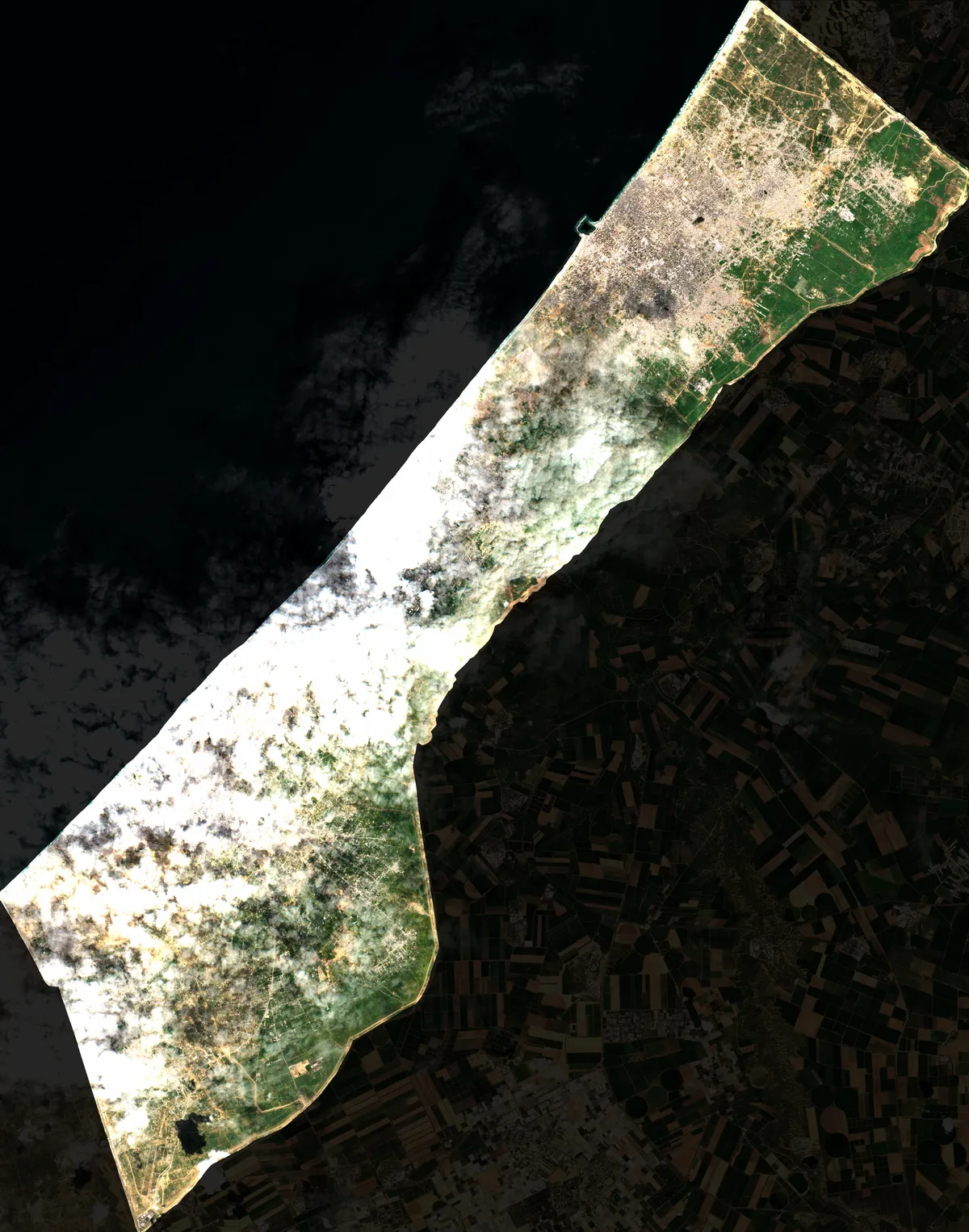
Coverage Analysis: 2026-02-28
Sentinel-2 Cloud Mask Overlay Visualization
⚠️ 66.8% Total Contamination
☁️ 58.8% Cloud Cover
🌑 8.0% Shadows
🛰️ S2B
📐 10m/Pixel
📖 Cite Me
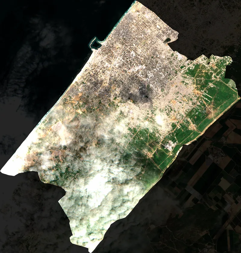
📍 Gaza
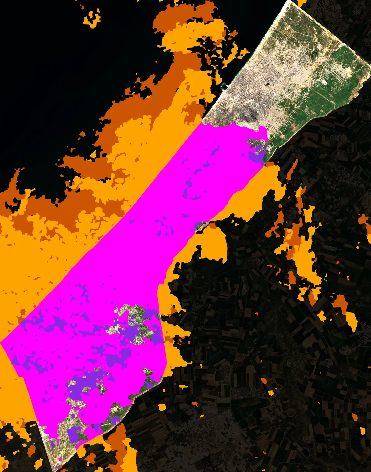
Clear
33.2%
4565018 px
Cloud
58.8%
8093805 px
Shadow
8.0%
1102353 px
📍 North Gaza
Clear
100.0%
1174767 px
Cloud
0.0%
0 px
Shadow
0.0%
0 px
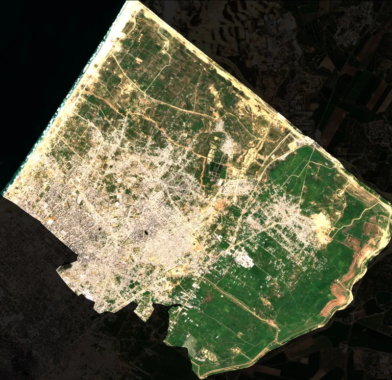
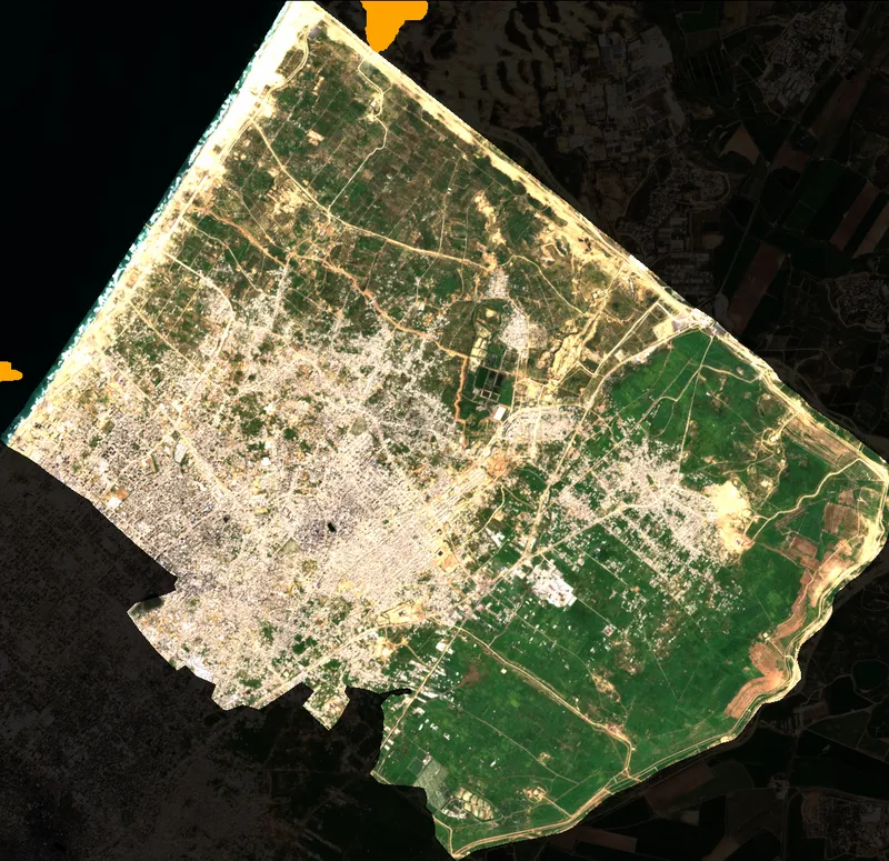
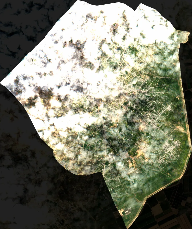
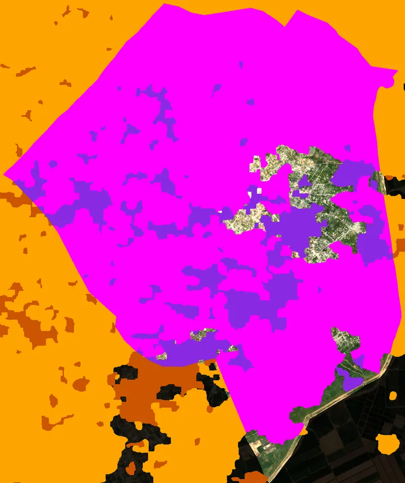
📍 Gaza City
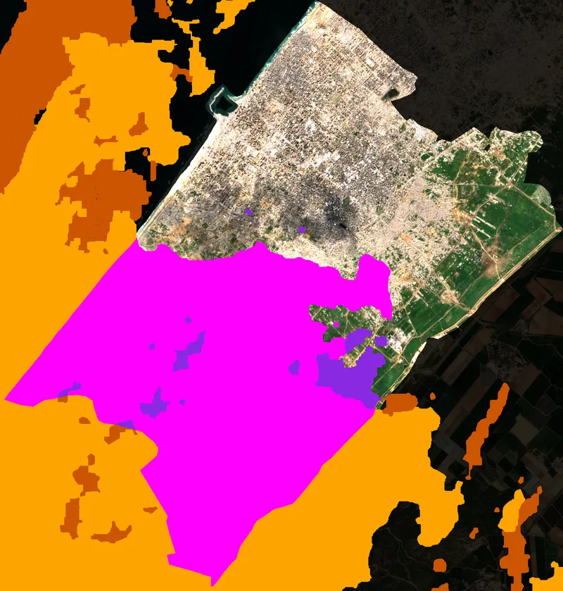
Clear
50.3%
874909 px
Cloud
46.7%
811794 px
Shadow
3.0%
52034 px
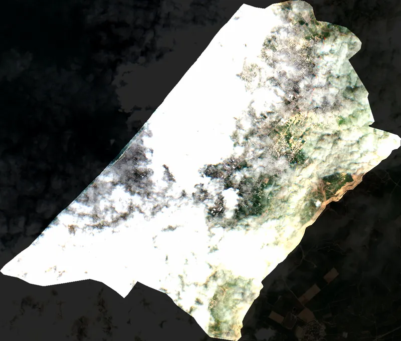
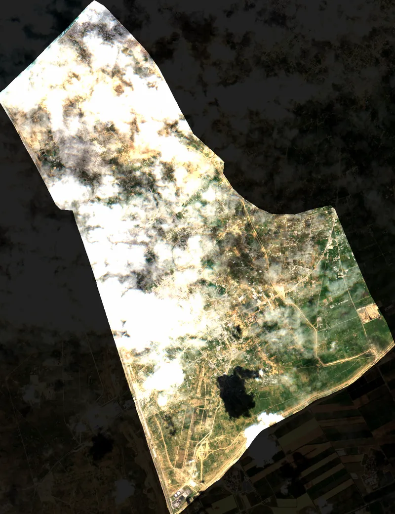
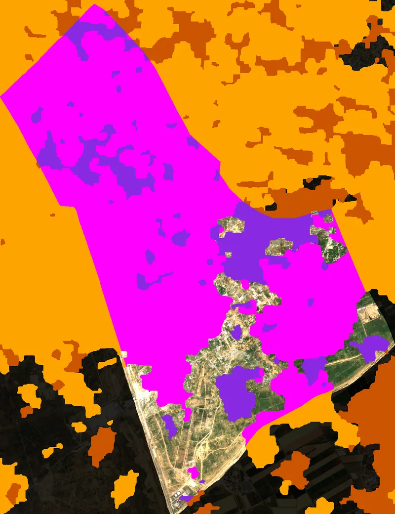
📍 Deir al Balah
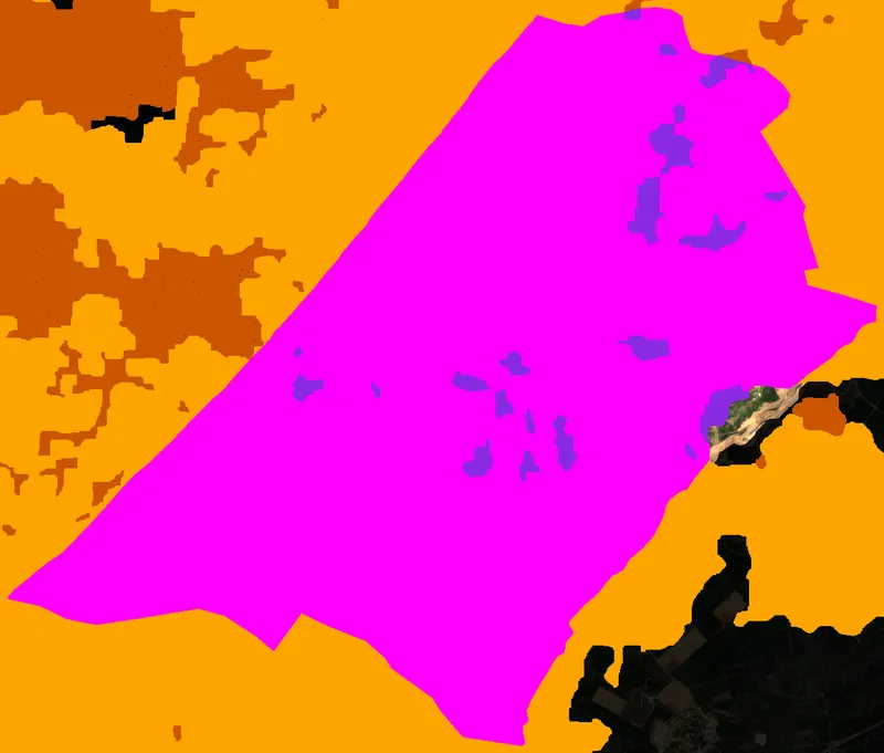
Clear
0.8%
9726 px
Cloud
95.6%
1236928 px
Shadow
3.6%
46946 px
📍 Khan Younis
Clear
8.2%
150783 px
Cloud
77.4%
1423602 px
Shadow
14.4%
265016 px
📍 Rafah
Clear
21.1%
321806 px
Cloud
64.2%
981438 px
Shadow
14.7%
225195 px